Monday, May 27, 2019

Part Two-Pinegrove Campground to Yellowhead Campground


Riding into the storm, Yellowhead Highway
Rick’s three wheeled electric bike, waiting out the rains.
Stealth Camp north of Avola, B.C.

Part One-Pinegrove Campground to Yellowhead Campground


May 22nd, 2019/Pinegrove Campground to North Thompson

Day's total/KM 78/elevation gain 622 meters
Total to date/KM 652.4/Total elevation gain 8799 meters 

I was packed and on the road by 8:15. Not too far out I spotted a Subway, I'm learning if it’s there and you need it then buy it. Sometimes just around the next corner is something better or nothing at all. Met my first cycle tourists at Subway, we chatted for a bit then leapfrogged once or twice as we all headed along the Yellowhead Highway. I caught up to them both at the next Subway stop and I’ve not seen them since. It was a decent day for riding, mixed sun and cloud but no rain. 

May 23rd, 2019/North Thompson to 20 km North of Avola

Day's total/KM 20/elevation gain 760 meters
Total to date/KM 672.4/Total elevation gain 9559 meters 

 It was a tough day. It soon warmed up and was the warmest day so far. Heavy storm clouds were brewing ahead. I stopped to allow one down poor pass. I was accompanied by another traveler, his name was Rick. He was on a home made electric powered three wheeler heading to Vancouver. This rig was totally dependent on the sun, it had no pedals. We chatted until the rains stopped then waited till the roads dried. The skies to the North were still black but I opted to press on till the next shower. I soon felt some big drops, I pulled over and geared up. The rain was continuous along with head winds and then sunny skies coming into Avola. My first flat, a rear, which forced a roadside repair.
I checked out the campground in Avola, it wasn’t much. It was situated amongst a bunch of derelict cars. There was an old motor-home that hadn't moved in years with a sign in the window with the camp hosts telephone number. I decided to press on and look for a place to stealth camp for the night. I ended up riding another 20 km’s North, it was getting late. There was a gas pipeline that paralleled the highway with service roads every few kilometers. One looked promising with the exception of the biggest bear paddy I think I've seen, I moved on. It was getting late. I pitched, set up and had dinner by 7. A bit of a restless sleep, it wasn't the bears that worried me. I would have felt more secure behind a gated road.
 
May 24th, 201920 km north of Avola to Blue River RV Resort

Day's total/KM 32/elevation gain 250 meters
Total to date/KM 704.4/Total elevation gain 9809 meters 

I woke up to the coldest morning so far. Made a quick coffee and had a sweet bun that I bought the day before, I was soon back on the road. I threw on the winter gloves and face mask. I saw my first two black bears, one was full grown and a good size.  The younger one took off as soon as it saw me. The bigger one was on an embankment above the highway, it was curious, likely it hadn't seen too many cyclists. Just South of the Blue River RV Park I pulled in for some lunch then pressed on another few kilometers. I met up with another cycle tourist, Kristof, he was from Germany and spoke good English. We talked and cooked dinner under the shelter, I did some much needed laundry. Later that evening along came another cycle tourist, Johnathon from Montreal.

May 25th, 2019/Blue River RV to Yellowhead Campground 

Day's total/KM 90/elevation gain 405 meters
Total to date/KM 794.4/Total elevation gain 10214 meters

 Kristof was first out followed by me then Johnathon. The idea was of course not to race, we each had our own pace and these two were much younger. Jonathon was traveling light and passed me about 30k in. I kept him in sight and we both soon caught up to Kristof, the race was on. We all rolled into Valemount somewhat together. The last hill which really wasn’t much took the last out of my already spent legs. Despite strong headwinds we had the 90 kilometers in the bag just shy of five and a half hours, I was tired but felt good. We all grabbed some groceries. Jonathon carried on North, I and Kristof split the cost and pitched alongside the river at the Yellowhead Campground.

May 26th, 2019/ Rest Day/Yellowhead Campground 

I opted to take a rest day. Truth be told my legs were a little sore from yesterday's shenanigans. This old dog needed a break! Kristof pressed on to Mount Robson so I was back on my own once again.

 There seems to be always something to clean, buy, wash or maintain. Much of the morning and early part of the afternoon was doing just that. The day flew by and I was ready to hop on the saddle tomorrow.

Monday, May 20, 2019

Part Two-Gott Creek Rec to Pinegrove Campground


Kamloops Lake
South Thompson River, Kamloops

Part One-Gott Creek Rec to Pinegrove Campground


May 16th,2019/Gott Creek to Lillooet

Day's total/KM 30.8/elevation gain 467 meters 
Total to date/KM 365.7/Total elevation gain 5328 meters

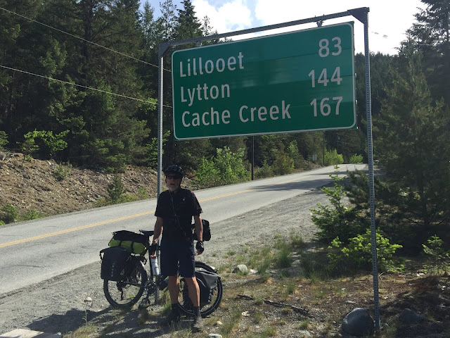
I woke to another overcast day at Gott Creek but no rain. The ride into Lillooet wasn’t too bad the scenery was spectacular. It’s a good descent coming in with a true hairpin as you drop down into the valley. I took it at speed and had the bike leaned so far I scraped a hole in my front pannier. I arrived at around 11:30 and rode directly to A&W for some real food. Did a bit of grocery shopping and made inquires as to whether there was a bike shop in town, no such luck. I opted to stay the night in Lillooet. The campground was situated just below town alongside the Fraser River, it's a beautiful spot. 
The following morning I awoke to rain, high winds and much cooler temperatures, I decided to spend another day.

May 17th/Rest Day

May 18th,2019/Lillooet to Marble Canyon

Day's total/KM 48.8/elevation gain 1101 meters
Total to date/KM 414.5/Total elevation gain 6429 meters

 I left Lillooet early, there was still a threat of rain, it only amounted to a few big drops and nothing more. It was a tough little section but the scenery was the big payoff. Once the highway climbs out of the Lillooet Valley your met with amazing views of the Frazer River that's carved deep into the valley below. Minimal traffic and a good workout made for a another great day on the bike.

May 19th,2019/ Marble Canyon to Steelhead Prov Park

Day's total/KM 76/elevation gain 431 meters
Total to date/KM 490.5/Total elevation gain 6860 meters

 After exiting Hwy 99 I headed south along 97 to Cache Creek, then east into Steelhead Prov Park along the TC. Despite being back into traffic it was a good day's ride. Later that evening I was invited to join a family that watched me cycle in earlier, they were curious. I told them about my trip thus far and couldn't believe my plans to cycle across the country.

May 20th/Steelhead Prov Park to Kamloops

Day's total/KM 42/elevation gain 920 meters
Total to date/KM 532.5 /Total elevation gain 7780 meters  
 A relatively short section with lots of low grade but long continuous uphills. It was a good steady workout for the legs. I arrived in Kamloops mid afternoon and headed directly to Atmosphere which is an outdoors store. Stove fuel for my old GAZ stove was no longer available. I had no choice other than to buy another stove that took the updated threaded canister fuel cartridges. I picked up some groceries, then lunch at Subway. 
I headed into old town then across the South Thompson River. I spent the night at Silver Sage RV Park. Nice campground rite alongside of the river. I test drove the  stove and it turned out to be defective!
 
May 21st,2019/Silver Sage RV Park to Pinegrove Campground

Day's total/KM 41.9/elevation gain 397 meters
Total to date/KM 574.4 /Total elevation gain 8177 meters

 I picked up a few more groceries while waiting for Atmosphere to open to exchange the stove. Cycle Logic was the next stop for a drive-train clean. The new chain I installed prior to leaving Victoria was 75% worn, I opted for a new one. I headed back to the RV park and collected the rest of my gear. As I pulled out of Kamloops I could feel the weight of groceries.
I followed Hwy 5 North, lots of truck traffic, for the most part I had a wide shoulder which was great. I arrived at the Pinegrove Campground at around 2:30. I pitched then headed for the shower, still with a little rest time before dinner.
Seton Lake, Lillooet


 Cache Creek, B.C.

Thursday, May 16, 2019

Nairn Falls to Gott Creek Rec Site


May 15th, 2019/Nairn Falls to Gott Creek Rec Site

Day's total/KM 70.8/elevation gain 1572 meters
Total to date/ KM 334.9/Total elevation gain 4861 meters

Since there were no bear proof bins at Nairn Falls parks staff locked my food in a storage shed, it was returned by 7 am, I was on the road by 8:30. Another great day weather wise, mixed cloud and sun. It was a nice down into Pemberton, I stopped in at McDonald's for coffee and a muffin. Then back on the saddle winding my way thru the Pemberton Valley. I was met with snow capped mountains either side and the warmth of the early morning sun. I plugged in the earbuds and peddled to the sounds of John Lennon, Lisa Gerrard and Paul Simon
I had soon crossed the Birkenhead River for the last time as it opened up into the Pemberton Wetlands. At this point the mountains box the valley in and the only route was up the Duffey Lake Road.
The climb began in earnest with grades impossible to peddle with a loaded touring bike, so I pushed, rested and pushed some more.
I spun the peddles a couple of times early on and a little more frequent as the climb continued towards the top. Five hours later I reached Joffrey Lakes, a few more kicks up past the parking lot and I was finally at the top. I let out a sigh of relief.

The Duffey Lake Road and the start of my five hour push to the top!
Duffey Lake and the Coastal Mountains of B.C.

Tuesday, May 14, 2019

Klahanie Campground to Nairn Falls


May 13th, 2019/Klahanie Campground to Nairn Falls

Day's total/KM 90.9/elevation gain 1423 meters
Total to date/ KM 264.1/Total elevation gain 3289 meters

I was packed and on the road by 8:30 am. I felt the first few drops of rain as I pulled out onto Highway 99, a sign of things to come. 
By the time I hit Squamish it was full on rain, fog and the temperature had dropped considerably. Looking further north the weather was worse. I rolled into the village of Whistler well past noon, soaked and cold. I spotted a Subway, they served up the worse sub and coffee, at-least it was warmer inside than out.
 I threw on some more layers and my winter gloves then headed out to do the last 30 km to Nairn Falls. About 8k from Nairn Falls the rain stopped allowing this drowned rat to dry out a little. I pitched then jumped into some warm dry clothes, it felt good to be warm and dry once again. It continued to rain off and on into the night.


Nairn Falls

I couldn’t resist “Larry’s Lookout”

Newcastle Island to Klahanie Campground

May 13th, 2019/Newcastle Island to Klahanie Campground

Day's total/KM 49.6/elevation gain 865 meters
Total to date/KM 173.2/Total elevation gain 1866 meters
I met up with a fellow cyclist prior to boarding for Horeshoe Bay. Terry was from Gabriola Island. We parked the bikes then headed upstairs and chatted over a coffee and muffin. Terry crossed Canada with two other riders along with a support Van in 2009. It was interesting talking to him and hearing all about his journey. It wasn't long before they announced the call to disembark. It felt damp and much cooler when the ferry doors opened, the coastal mountains were obscured in fog. I made my way through the rather confusing exit up onto Highway 99.  For the most part the shoulder was wide allowing a reasonable buffer between me and the continuous flow of traffic. A couple of sections where the shoulder was minimal with a sloped curb, I opted to push for safety.

Sea to Sky Highway
Britannia Beach

Saturday, May 11, 2019

Ruckles Prov Park to Newcastle Island


May 10th, 2019/Ruckles Provincial Park to Newcastle Island, Nanaimo

May 11th, 2019/Rest Day/Newcastle Island, Nanaimo

May 12th, 2019/Rest Day/Newcastle Island, Nanaimo

May 13th, 2019/Rest Day/Newcastle Island, Nanaimo
 
Day's total/KM 69.6/elevation gain 662 meters
Total to date/KM 123.9/Total Elevation gain 1055 meters

I was packed and on the road by 8:00 am, another beautiful day. I stopped in Gangies at the EMBE Bakery for a coffee and muffin.
The ride to Vesuvius was hilly, traffic for the most part was respectable allowing plenty of room as they passed on the narrow island roads.
The crossing to Crofton was about 30 min. I followed the Old Crofton Road, then hoped on a new section of the Cowichan Valley Trail.
I swung onto Hwy 1 at Ladysmith which took me all the way into Nanaimo.
I met up with family for three nights on Newcastle. Weather was great, lots of good food, a few beers ;-) and lots of hikes and exploring around the island.


Vesuvius Bay to Crofton Ferry


Newcastle Island, Nanaimo

Friday, May 10, 2019

Finally under way


May 9th, 2019/Mile Zero to Ruckles Provincial Park, Saltspring Island

Day's total/KM 54/elevation gain 393 meters
Total to date/KM 54/elevation gain 393 meters

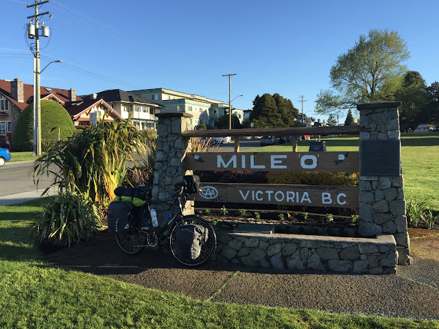
It was 7 am and I was officially underway. I headed toward Victoria’s Mile Zero for pics then a dip in the Pacific with the rear wheel.
I followed the Lockside Regional Trail to Swartz Bay Terminal, about 44 km then caught the ferry to Fulford Harbour, Saltspring Island. Crossing time 30 min.  It's a short ride to  Ruckles Prov Park, 10 km's but real hilly as much of the Gulf Islands are. 

The campsites are walk in only situated on a grassy, treed point. It's a beautiful place to pitch a tent, hike the trails, visit the old heritage farm buildings or just relax and take in all the activity on the straits. If your lucky enough it's not uncommon to spot a pod of Orcas. 


Mile Zero, Victoria 
Ruckles Prov Park, Saltspring Island

Wednesday, May 8, 2019

The weight list


My intent is to camp, the fewer hotels the better and cook meals as often as I can. I've used some gear from my backpacking day's and the rest I've bought over the past year.
Here's how it all wrapped up: The bike with three full water bottles, racks, fenders, pump etc weighs 41.5 pounds. Camping gear, clothing, all that's on the list below weighs 59 pounds. Foods extra, I'll try to keep that at a minimum, some sections will have little or no food stores so I'll need to carry extra at times.

Bike setup:
Surly Disc Trucker 56cm, 26", fenders
Brooks B17 saddle
Schwalbe Marathon Plus Tires
Tubus Tara Big Apple Lowrider Front Rack
Tubus Logo Evo Rear Rack
MKS Lambda peddles with power grips
Zefal Frame Pump
Bike bell
Plastic bag for seat cover

Bike clothing and misc:
Arkel 45L Rear Panniers
Arkel 35L Front Panniers
Arkel 7.5 liter handlebar bag
2 Bib Shorts

1 Light Cycling Shorts
2 Cycling Tops
High Viz Vest
Arm/Leg warmers
Gloves/Winter 1/Summer 2
Drencher Glove Covers
Rain Jacket
Rain Pants
Rain Shoe Covers
Buff 1
Face cover
Socks/2 medium weight/2 light weight
Helmet
Helmet Rain Cover
Reflective Safety Straps 2
Slip on Merril shoes
Riding glasses/cloth pouch
Cable and lock
Headlamp/helmet mount

Rear safety flashing light
Triangle Reflector

Off the bike clothing:
Icebreaker 100 weight long sleeve top
Nylon pants
Tuque/Ball cap
Socks 1
Underwear 1
Undershirts 1
Shorts/soft belt
Swim shorts
Down jacket/also a pillow(reversible fleece lined stuff sack)
Nylon bag for laundry/shopping
Thermal underwear bottom/top
Crocs 1pr

Camp stuff:
Sierra Design Half Moon Plus 2 man tent
Ground sheet
Sleeping bag/bag liner
4 season Therm-a-rest sleeping pad/patch kit
Scoot Guard 3'x3'
Dry bags 2
6 nylon straps
Tent Candle lamp/1 spare candle

Cooking stuff:
Gaz butane/propane stove
Stove fuel/1 lb bottle
Flint and Steel
Cooking pots/large/small
Vietnamese coffee dripper
Bowl
Plastic mug
Plastic spoon/fork/knife
Leather-man multi purpose knife
6L water bladder(empty)
Campsuds/sponge

Tool kit:
Tire levers/patch kit
Spare tube
Allen wrenches 6
15mm/8mm wrench
Chain oil dry 1
Chain Brush
Cleaning cloth
Zip ties/electrical tape/duct tape(small rolls)
Latex gloves 1 pr
Brake pads 2 sets
Tire Pressure gauge/digital
2 spare master links
Light weight ratchet/torques, Phillip bit
Spoke wrench

Personal:
Sunscreen
Sudocrem
Nok Cream
Water pills
Tylenol/Ibuprofen
Deodorant
Bug repellent
Mosquito net for head(might help)
Small selection of band-aids
Tooth brush/paste/floss
Bar soap/container
Wet wipes
Small brush
Reading glasses/case/glass cleaner/cloth
Eye drops
Sunbum lip balm 2
Nuun electrolyte tablets 2 

Camp towel/flannel
Light rope for laundry line
Wallet
Pen
Mighty ear plugs
Q-Tips
Cloth pegs 6
Large nail clippers
Antibiotic ointment
Passport
National park pass

Electronics:
Nomad 14 plus solar panel/3 small bungy cords to secure to back rack)
Misc charge cords/wall plugs
Ravpower battery pack 26800 maH
Iphone 6/holder/ear buds
Ride with GPS software


Gear

I soon realized camping with panniers was going to require some organization. I marked the left pannier handles with duct tape. Using a small set of kitchen scales I weighed all the gear. The bike was weighed using bathroom scales.
I entered the data into an Excel spread sheet. It allowed me to move the gear around to distribute for weight and bulk while trying to keep things grouped in a somewhat logical order. I then grouped items in mesh stuff sacks.
Here's an example of the screen shot I have for reference on my Iphone.


Right Front Pannier Gear List

About La tour


Hi there,

How did I come up with the name "The Adventures of Gruncle". The name Gruncle was given to me by my nephew and his wife when their first child was born. She will soon be three and only knows me as Gruncle, it's kind of stuck. Oh my other name is Larry.
I bought my Surly Disc Trucker last July. After lots of internet research it was the bike that best suited my present and I hope my future needs. I've slowly since that time been acquiring the rest of the gear, panniers, clothing and the list goes on. I also put to use some equipment from my backpacking day's.
 Crossing Canada will be my first long distance tour. In preparation I've clocked many single day rides, a number of overnighters and multi day trips testing gear and me. It's all finally coming together and it's now just weeks away. Departure is set for early May. I've mapped the route using Ride with GPS, I will also Google Maps. I've no doubt there will be minor, maybe major route changes as I go along.
Below is a rough estimate as to where I'll be and when. At this point I'm really uncertain as to how many kilometers I can do per day or back to back with a fully loaded touring bike, we'll see how it all unfolds.  


May/Depart Victoria to Saltspring Island, Whistler, Mt. Robson
Mid May/early June-Jasper, Banff, Alberta and Saskatchewan
Mid June/early July-Saskatchewan, Manitoba and Ontario
Mid July/early August-Ontario and Quebec
Mid August/early September-New Brunswick, P.E.I. and Nova Scotia
Mid September-Newfoundland
Late September-Fly back to Victoria


My Surly Disc Trucker, Sooke, B.C.